 Your Feedback Is Important
We are continually updating this document. If there is any information that you would like us to add or change, or if you have questions, please contact SiteSee Support. Thank you.
Accessing the Web Portal
Loading a Job
3D View
Navigation
Layers
Layer Types
Markers Layer
Panoramas Layer
Cameras
Measurements
Accessing the Web Portal
The SiteSee Web Portal is an interactive website designed specifically to provide users with convenient online access to deliverables such as 3D reality models and site reports. To access it, if you don't have a client-specific custom URL, go to https://app.sitesee.com.au.
 Data Security
We understand the importance of data security. Our Web Portal features
- user access and management in a restricted access environment that offers multi-factor authentication for a more secure sign-in;
- encrypted communications and operation processes using industry-standard transport protocols between user devices and data centres and within the data centres themselves; and
- advanced protection against online threats, including intrusion detection, denial-of-service (DDoS) attack prevention, regular penetration testing, and data analytics and machine learning tools to help mitigate threats.
 Compatibility
The SiteSee Web Portal is designed to be used on a PC (i.e. not a tablet computer) and is compatible with most modern Internet browsers.
 Quick Start Video Tutorial
The video below provides a quick overview of the SiteSee Web Portal interface components and how to use them.
Loading a Job
- Upon loading the SiteSee Web Portal, the default page displayed is 'Jobs'. If you have previously used the Uploader, select 'Jobs' in the main menu to switch to the Web Portal. A map of the sites you have access to will be displayed.

- Search the map, or use the pan and zoom functions of your mouse to find the site you are interested in. When you start typing in the search box (e.g. date, job number or name, or location), the matching jobs are listed underneath the search box.

- You can also use the list view to search for specific sites. To access the list view, click
 . As you type in the search box, the job list updates progressively to display the jobs that match your entry.
- In the list view, select 'View Report' to download various site reports (reports can only be accessed in the list view). The reports available include as-built, rust, and EME. The as-built and rust reports can be downloaded as either a PDF or comma-delimited CSV file. The EME report is only available as a PDF file.
- Select 'Open' to view the interactive 3D reality model.

3D View
Navigation
Once the 3D model has loaded, use your mouse to navigate it as follows:
- Left-click and hold the mouse button to rotate the model around the rotation centre.
- Right-click and hold the mouse button to shift the rotation centre.
- Use the mouse wheel to zoom in and out relative to the rotation centre. Note that, to maximise load speed, SiteSee uses dynamic Level of Detail (LoD), that is, the resolution of the 3D model increases as you zoom in. Depending on the speed of your internet connection, LoD may take a few seconds to update and display maximum resolution.
- You can also use the arrow keys on your keyboard to rotate the model.
- The layer sidebar can be collapsed/expanded by clicking on its arrow.
Layers
Layer Types
Switch on the layers shown in the left sidebar as desired. Note that, depending on the job specifications, not all layers shown below are available. For example, the layers Markers, RadHaz, Rust and Panoramas are optional, and only the relevant equipment layers will be shown (e.g. the Dishes layer is only available, if dishes are installed).
Turning on layers highlights the corresponding information in the model. While a layer is switched on, select the ![]() icon, then click on a highlighted area to show detailed information about it. Click on the
icon, then click on a highlighted area to show detailed information about it. Click on the ![]() icon again to exit this mode.
icon again to exit this mode.

Markers Layer
The Markers layer (optional) shows issues that were marked by you or other users in your group (e.g. damage, missing bolts, birds' nests, etc.).

Select the ![]() icon, then click on a marker to show detailed information about it or to edit/delete it. Click on the
icon, then click on a marker to show detailed information about it or to edit/delete it. Click on the ![]() icon again to exit this mode.
icon again to exit this mode.
To create a marker, click the marker icon in the toolbar:

Now click on a point in the scene and input the marker details, then save the marker.
See the section Marker Report below for instructions on how to display a list of all markers for your group.
Panoramas Layer
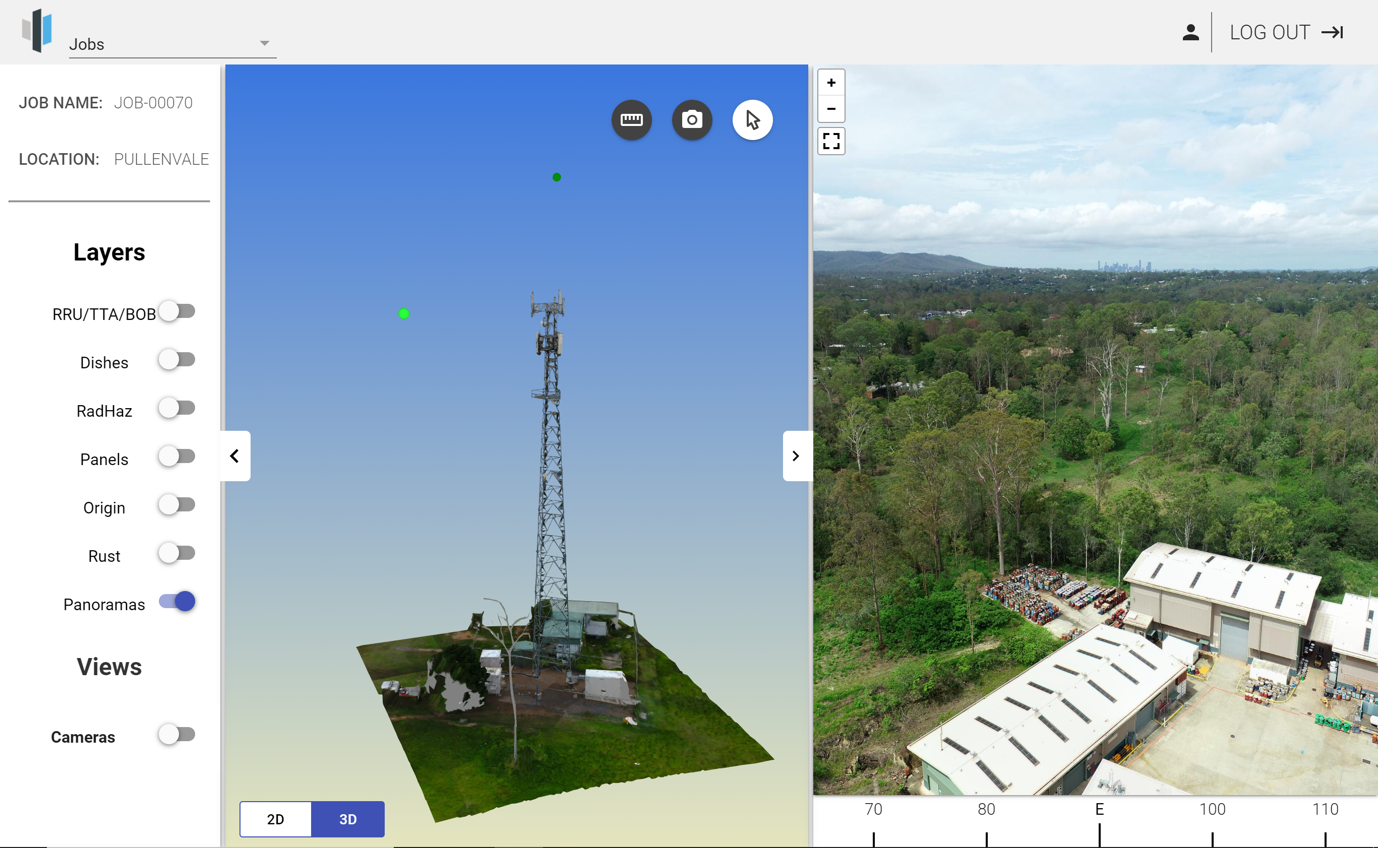
The Panoramas layer (optional) shows the location of panoramas as green dots. While this layer is switched on, select the ![]() icon, then click on a panorama location to display the panorama in the right sidebar.
icon, then click on a panorama location to display the panorama in the right sidebar.

Use your mouse to navigate the panorama. The bearing of the current view is shown underneath it. Click ![]() to switch to full screen mode.
to switch to full screen mode.
Cameras
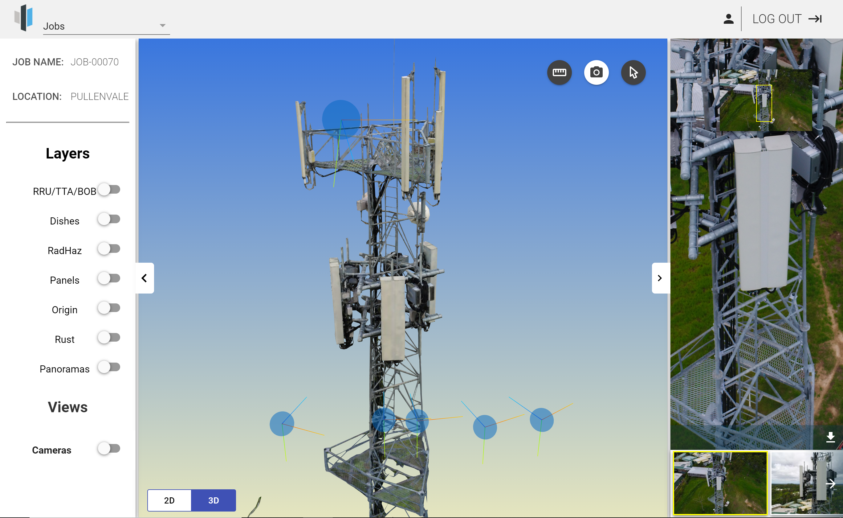
In the left sidebar, turn on cameras to see how the tower was captured.

Select the ![]() icon, then click on a camera to show its image in the right sidebar. Use your mouse to navigate the image. Click on the
icon, then click on a camera to show its image in the right sidebar. Use your mouse to navigate the image. Click on the ![]() icon again to exit this mode.
icon again to exit this mode.

Move the mouse cursor over the image in the right sidebar to display the download icon ![]() . Click it to download the image.
. Click it to download the image.
Alternatively, click on the ![]() icon to display the images pertaining to a specific part of the 3D model. In this mode, clicking on a part of the tower displays all images showing this part. Click on the
icon to display the images pertaining to a specific part of the 3D model. In this mode, clicking on a part of the tower displays all images showing this part. Click on the ![]() icon again to exit this mode.
icon again to exit this mode.

Measurements
Click the ![]() icon to measure distances. After turning on this mode, click on the model to set the start and end points. Click on the
icon to measure distances. After turning on this mode, click on the model to set the start and end points. Click on the ![]() icon again to exit this mode.
icon again to exit this mode.

Compass
The compass bearing of 0/360 is indicated by the green axis of the rotation center. (left click)

2D View
If a 2D view is available,  is shown at the bottom of the screen. Click 2D to display the orthomosaic.

Use your mouse to navigate the 2D view and to zoom. Click ![]() to change the display mode.
to change the display mode.
Use the measurement tool ![]() to measure distances and areas.
to measure distances and areas.

To remove a measurement, select it and click Delete.
You can view the cameras as well as panoramas and tracks (the latter are optional features that are only available if you specifically requested them). Once you have turned on Tracks, clicking on a highlighted track will open Trackview in the right sidebar which can be navigated by clicking on the arrows and zoomed using the mouse wheel:
Marker Report
You can view a list of all markers created by you and users belonging to the same user groups as you as follows:
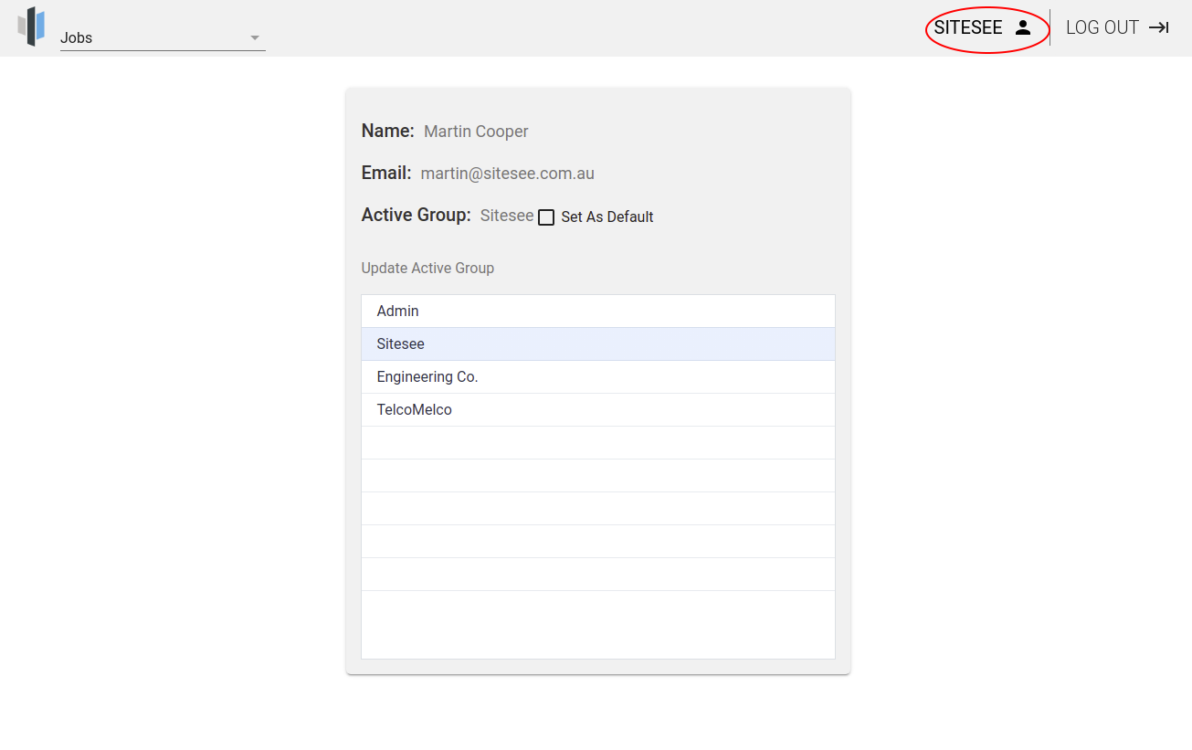
- Click the user profile icon to select a user group (you can only see groups you are a member of):

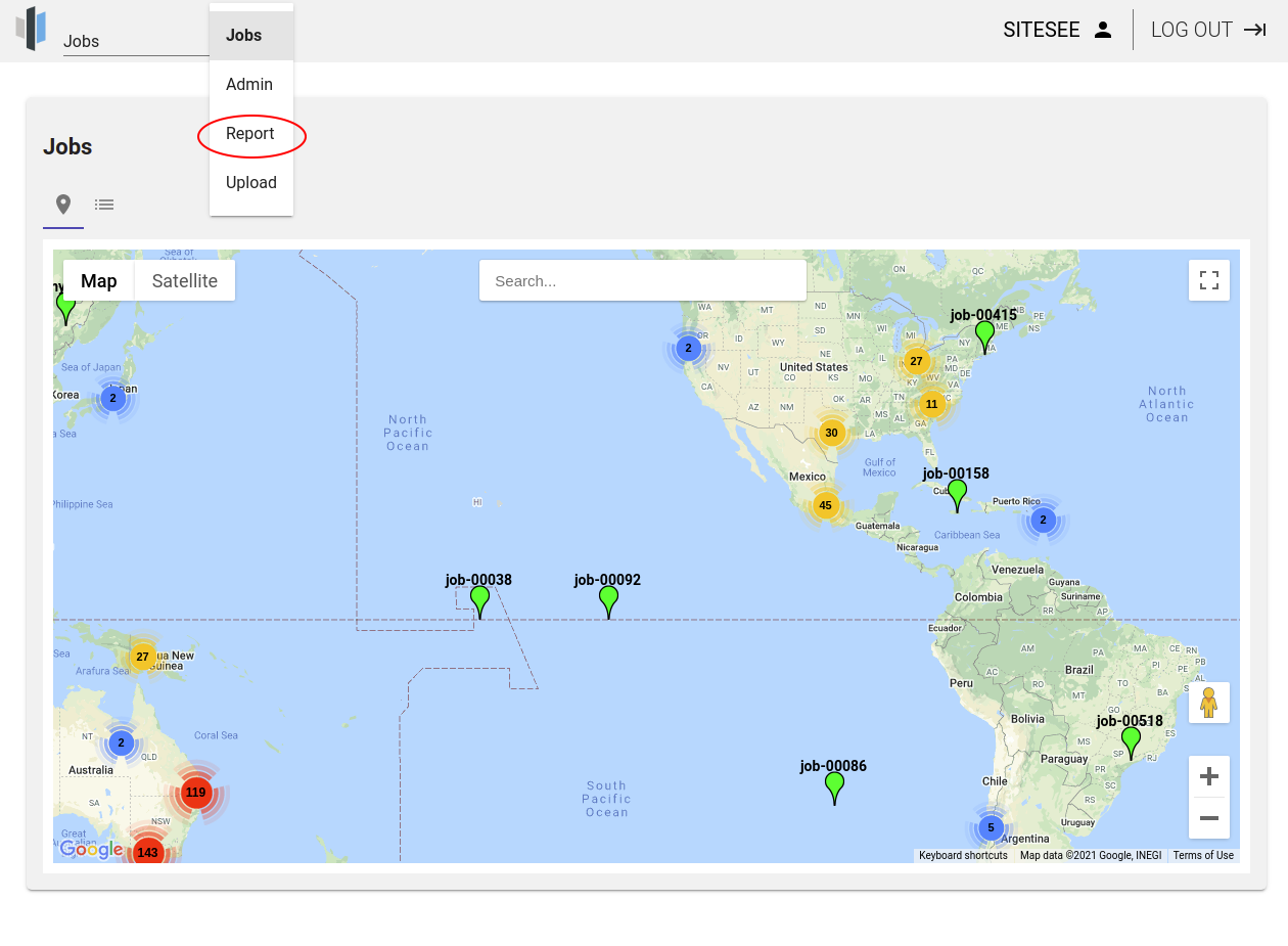
- In the dropdown menu, select 'Report' (this menu item is only available if the selected user group is authorised to create markers):

- On the report page, you can now search all the markers that have been created by members of this group. You can search by either location or title. If you leave these fields empty and click Search, all markers will be listed:

- If you would like to export items in this list (comma-delimited CSV text format), select them (as shown in the screenshot above), then click 'Export selected items to CSV'.
