 Your Feedback Is Important
We are continually updating this document. If there is any information that you would like us to add or change, or if you have questions, please contact SiteSee Support. Thank you.
The purpose of this tutorial is to help new SiteSee customers learn how to plan flights using the SiteSee Mission Planner app without having to go onsite. Instead, by using the simulator feature of the DJI Assistant software, it allows new pilots to practice the entire flight planning procedure from the comfort of their desk. This means you can get started without having to find a suitable tower first or wait for good weather. And by the time you attempt to capture a real tower, you are already familiar with the flight planning procedure.
 Important
Please follow the instructions in this document in the order they are provided!
Preparation
- Carefully read our Mission Planner capture guide. Note that the procedure below is slightly different because a simulation will be performed instead of an actual capture. However, reading the guide first will help you understand the simulation process in the context of the overall capture procedure used in the field.
- Depending on your preferences, open either the metric or imperial version of the Operator Checklist spreadsheet. Click on each of the tabs 'Cell Tower', 'Calibration', 'Main Run' and 'Final Run' and check that all yellow cells are empty. If this is not the case (i.e. another user forgot to copy the spreadsheet before using it) clear the cells. Then make a copy of the spreadsheet (File > Make a copy), name the copy Simulation-Trainee (replace 'Trainee' with your name) and share it with Thomas.Loetscher@sitesee.io. This will assist us in helping you complete this tutorial.
- Install the Mission Planner app on your Android tablet PC.
- Download the correct version of DJI Assistant 2 for your drone from the DJI website and install it on your PC (Windows or iOS).
- Ensure your PC is connected to the internet and open DJI Assistant. Connect your drone via USB to your PC and turn it on (do not install the drone’s propellers). Wait for DJI Assistant to detect your drone, then click on it.
- In the DJI Assistant sidebar, click on 'Firmware Update' and perform any updates required.
- Click on 'Calibration' and follow the onscreen instructions.
Simulation Procedure
The instructions provided in this section are based on our Mission Planner capture guide and assume that you have read this guide. The simulated flight planning procedure differs from this guide mainly in that it omits Step 2 (Determine Tower Dimensions) and Step 6 (Launch Mission). Step 2 is not necessary, because you will use a virtual tower specified in this tutorial instead of a real tower; and while Step 6 could be simulated, doing so would be both confusing and time-consuming. Hence, the procedure described below only simulates the following steps in the guide:
Input Cell Tower
- Open the Operator Checklist spreadsheet you created (see section Preparation above), go to the tab 'Cell Tower' and enter the following specifications of the virtual tower you are going to use for the simulation (either in m or ft, depending on whether you are using the metric or imperial version of the spreadsheet):
Tower Height 32 m (105 ft) Tower Radius 1 m (3.3 ft) Array 1 - Antenna Height 29.5 m (97 ft) Array 1 - Antenna Distance from Tower (DfT) 2 m (6.6 ft) Array 1 - Antenna Thickness 2.5 m (8 ft) Array 2 - Antenna Height 24 m (79 ft) Array 2 - Antenna Distance from Tower (DfT) 1 m (3.3 ft) Array 2 - Antenna Thickness 2 m (7 ft)
 Only Enter Data in Yellow Cells
In the Operator Checklist spreadsheet, only enter data in yellow cells. The white cells are calculated and not intended for user input. - Ensure an empty SD card is inserted in your drone.
- Open DJI Assistant and connect your drone as explained in the section Preparation above.
- Click on ‘Simulator’ and open it.
- In the simulator, enter the latitude (-27.51341) and longitude (152.97466). Leave all other settings at their default (see screenshot) and click ‘Start Simulating’. Your drone now thinks that it is positioned at the above coordinates and ready to fly.
- Make sure that your tablet PC is not connected to your drone’s remote control (RC). Turn on both the RC and tablet PC (the tablet PC must be connected to the internet).
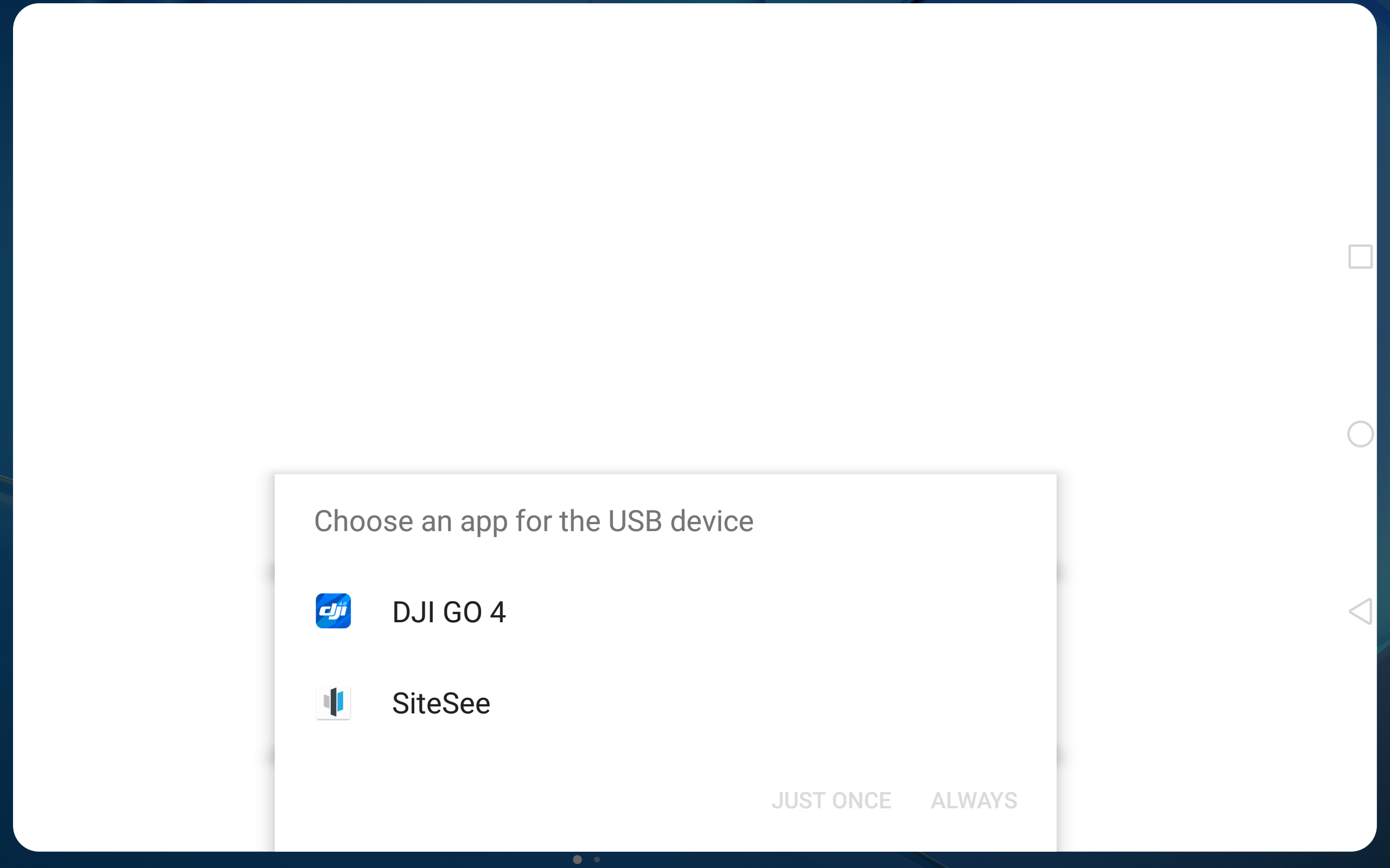
- Plug your tablet PC into your RC, then select SiteSee and tap ‘Just Once’.
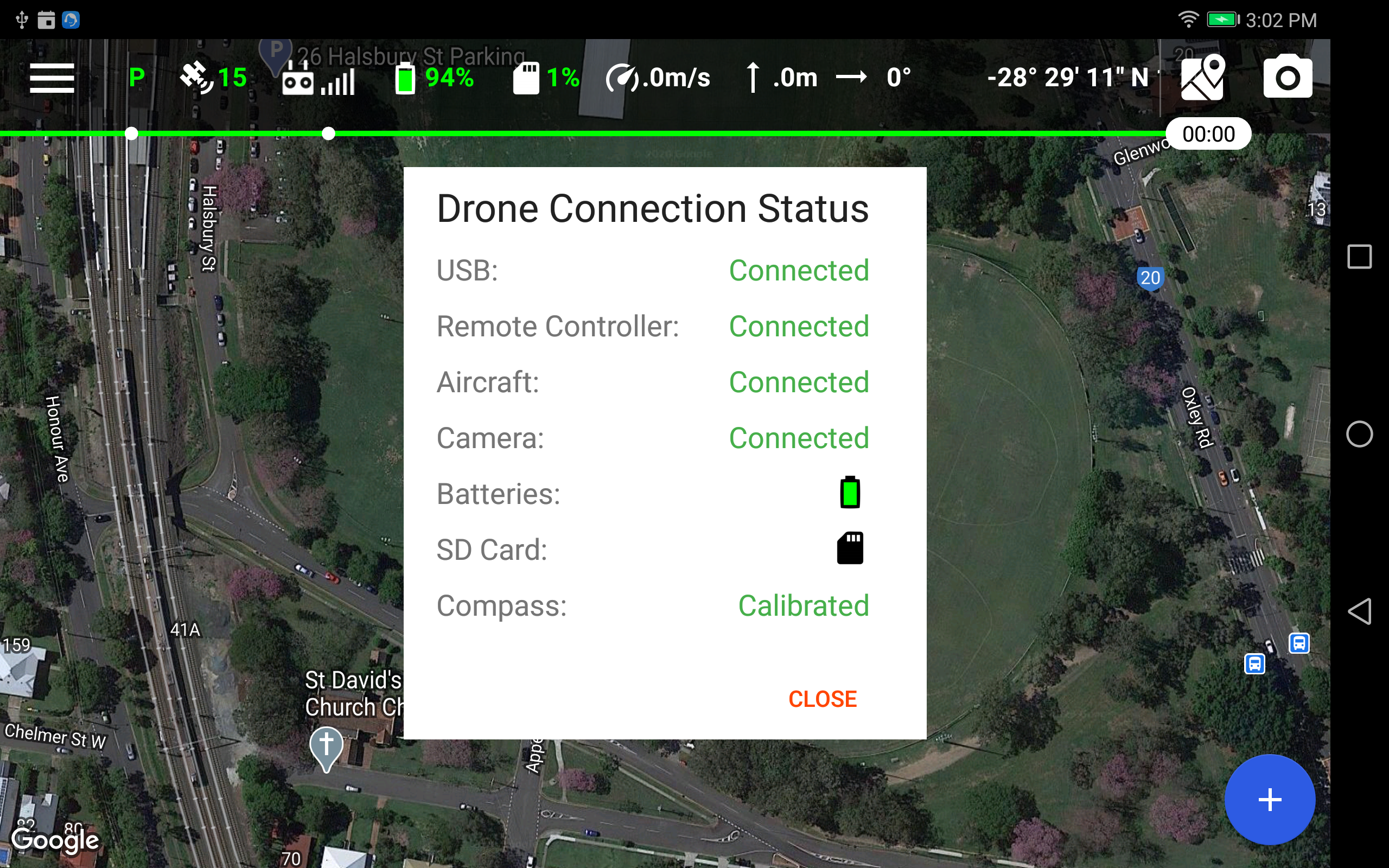
- Wait for the Drone Connection Status to update as shown below and tap ‘Close’.
- Tap on the map icon
 and then on
  center the map. You should now see the simulated position of your drone as shown below. If this is not the location you see, you have entered the latitude and longitude incorrectly in DJI Assistant (see step 5 above).
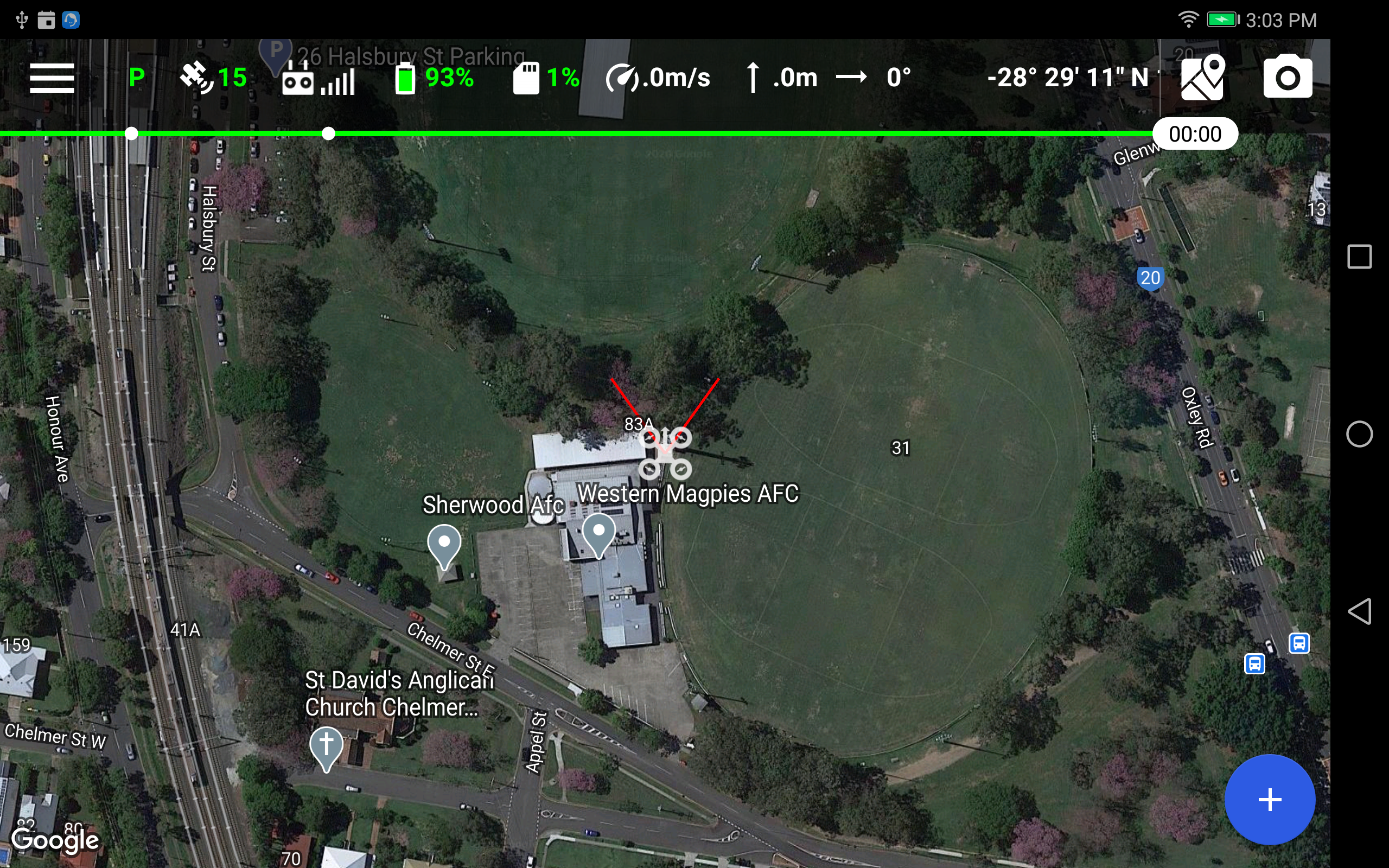
Use the 2-finger gesture to zoom in. You should be able to clearly see the tower and its shadow. - In the Automatic Image Acquisition guide, go to Step 3 - Input Cell Tower and follow the step-by-step instructions. Note that the simulation differs from these instructions as follows:
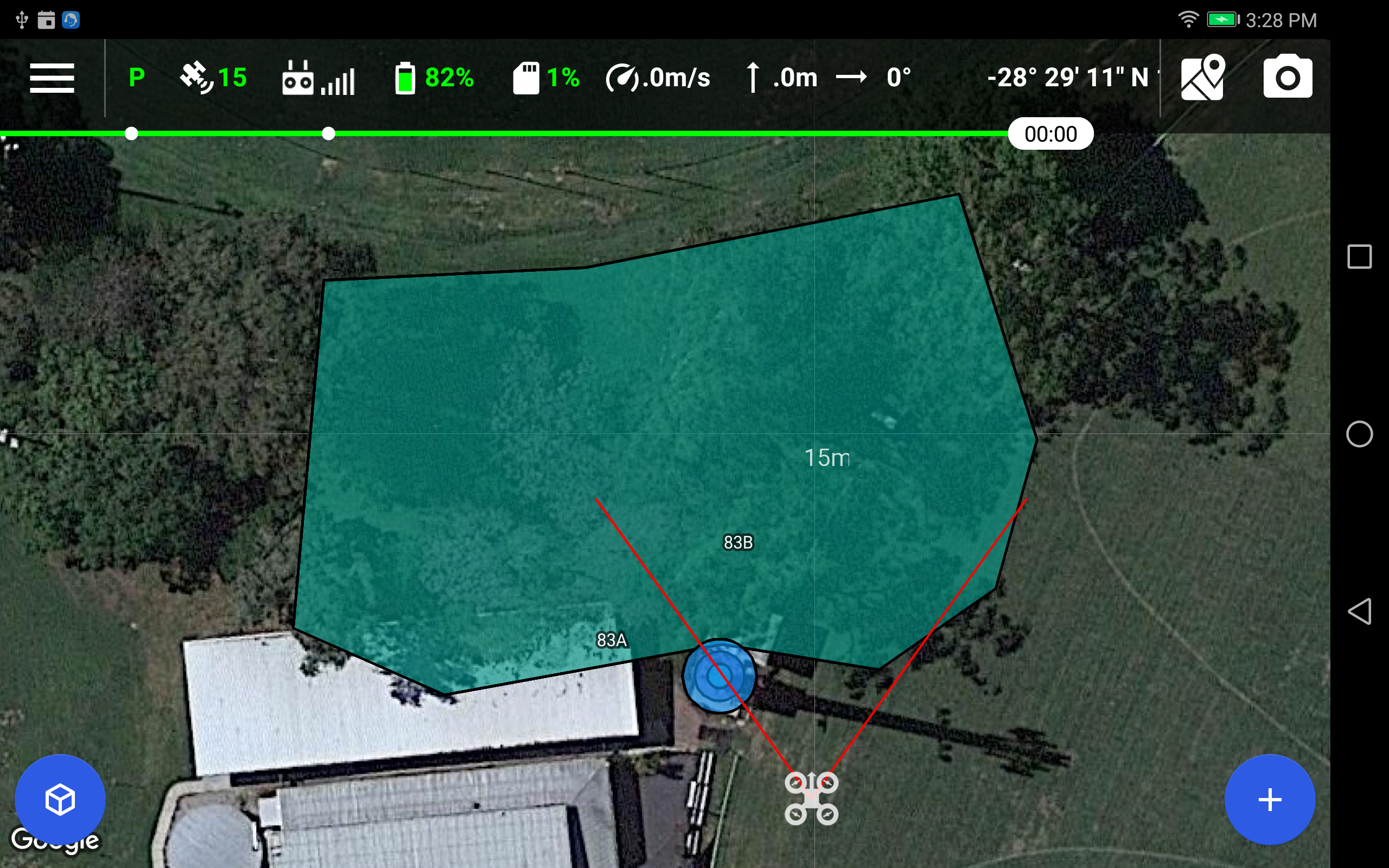
- When asked to input obstacles, enter the trees to the north of the tower as a single 15 m (49 ft) high obstacle similar to the one shown in the screenshot below.
- For the tower and antenna specifications, enter the values in the tab 'Cell Tower' of the Operator Checklist spreadsheet.
Create Flight Plans
In the Automatic Image Acquisition guide, go to Step 4 - Create Flight Plans and follow the step-by-step instructions. Note that the simulation differs from these instructions as follows:
- When asked, set the simulated drone position
 as the Liftoff position.
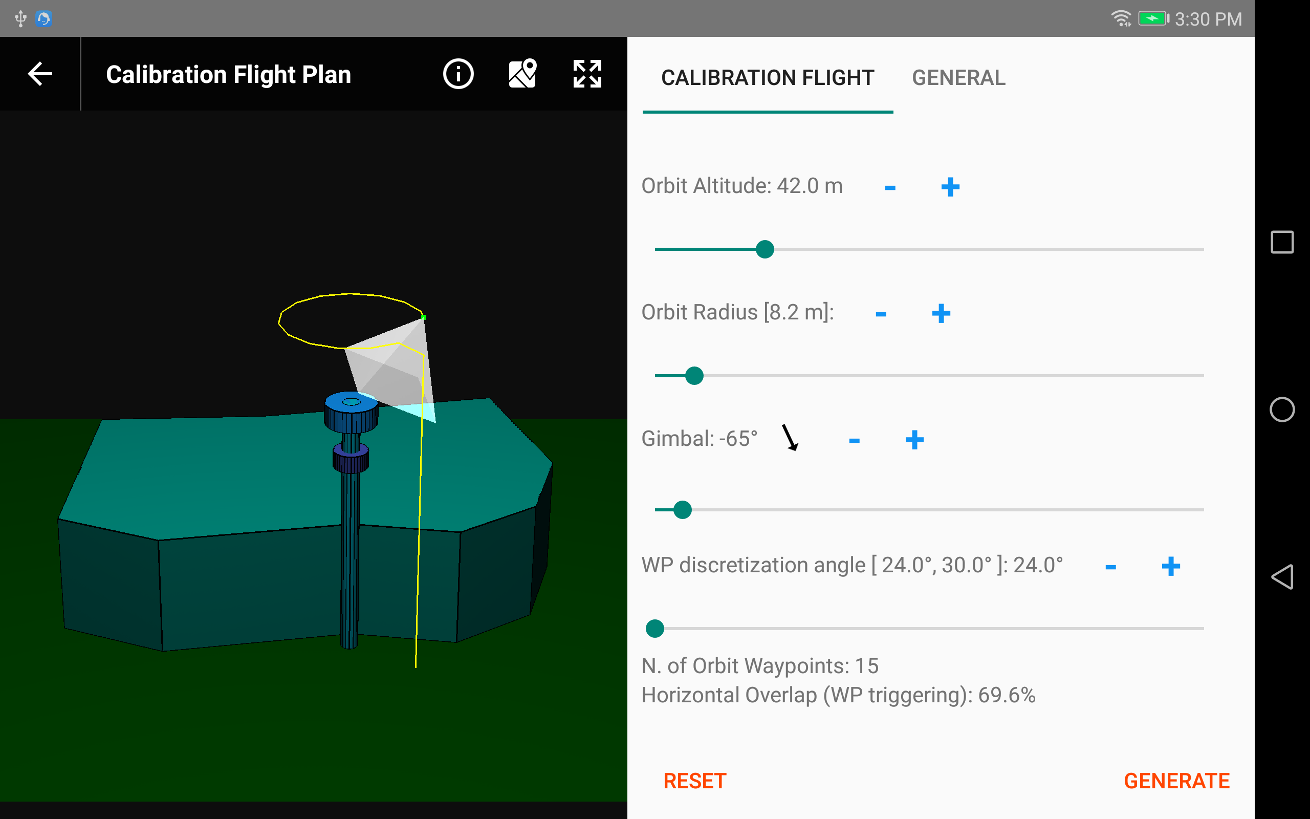
 - For each of the three flights (Calibration Flight, Main Run, Final Run), set the flight parameters to the automatically calculated values in the corresponding tabs of the Operator Checklist spreadsheet (column 'Default'). The screenshot below shows the completed Calibration Flight.
 Calculating Flight Parameters
Instead of the Operator Checklist spreadsheet, you could also calculate the parameters for each flight yourself based on the respective tables in the guide. However, this is a more error-prone approach, and we strongly recommend using the spreadsheet instead.
 Send Flight Plans to SiteSee for Assessment
When you have completed all three flight plans, follow these instructions to save them. Then tap
Adjust Camera Settings
In the Automatic Image Acquisition guide, go to Step 5 - Adjust Camera Settings and follow the step-by-step instructions. Please also do the following:
Before closing the camera settings (step 8), take a screenshot. On most Android devices this is done by simultaneously pressing the volume-down and the power buttons. You can also simply take a photo of the screen, for example with your smartphone.
 Send Screenshot to SiteSee for Assessment
Send the screenshot of the camera settings to Thomas.Loetscher@sitesee.io. We will then review the settings and provide you with feedback.
